What a 3D Drone Survey Is For
We carry out RTK 3D drone surveys for construction sites, buildings, historic assets and land, across Italy. With the DJI Matrice 4E and the D-RTK 3 station we obtain a georeferenced metric model with centimeter-level absolute and sub-centimeter relative accuracy, delivered as a point cloud, 3D mesh, orthomosaic, DTM/DSM, contour lines and CAD sections, plus a web viewer to measure directly in the browser. Data is delivered in under 36 hours. Prices start from €350 plus VAT.
At a glance
- Service
- 3D surveys, photogrammetry and drone inspections
- Equipment
- DJI Matrice 4E drone with integrated RTK and DJI D-RTK 3 Mobile Station
- Accuracy
- Absolute centimeter-level, relative sub-centimeter
- Deliverables
- Point cloud, textured 3D mesh, 2D orthomosaic, DTM / DSM, contour lines, CAD sections, 3D web viewer
- Formats
- LAS / LAZ, OBJ / MTL, DXF / DWG, GeoTIFF, 3D Tiles, technical PDF
- Turnaround
- Data delivered in under 36 hours
- Area
- All of Italy (registered office in Trieste, operations office in Zanè, VI)
- Qualifications
- Pilots with a drone license (Open category): Glauco Amoroso A1/A2/A3, Mauro Amoroso A1/A3. Activity covered by insurance.
- Price
- From €350 + VAT. Quote within 24 hours
Topography & Construction Sites
Georeferenced data with centimeter-level accuracy to monitor progress and plan excavations.
Inspections & Monitoring
High-resolution structural checks without setting up scaffolding or risky elevated platforms.
Restoration & Architecture
Millimetric surveys of complex facades and listed buildings for reliable diagnostics and quantity take-offs.
Ready-to-use data for CAD and GIS
All files are scaled, georeferenced and compatible with your working software. Tap a card to learn more.
 Point Cloud
 DTM / Elevation
 Sections & Elevation Profiles
Technology Used

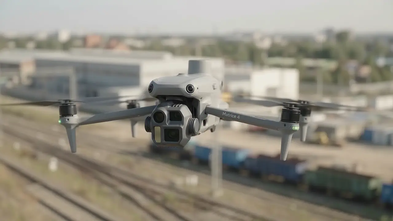
DJI MATRICE 4E
To deliver the highest-quality 3D surveys we use the DJI Matrice 4E, a professional drone with integrated RTK, designed to capture accurate data even in the most complex environments.
The integrated RTK system guarantees absolute centimeter-level and relative sub-centimeter accuracy.
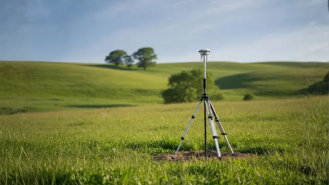
DJI D-RTK 3 MOBILE STATION
To maximize the accuracy of the data collected by the drone, we also use the D-RTK 3 High-Precision GNSS Mobile Station, a latest-generation base station.
It guarantees flawless signal stability even in areas with poor coverage or magnetic interference.
3D Survey Projects Completed
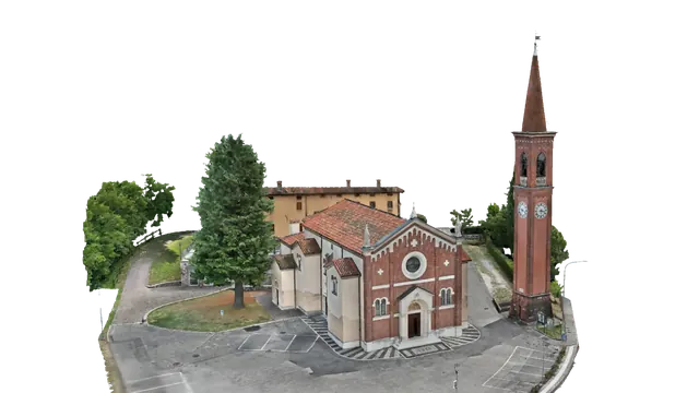
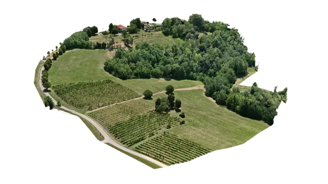
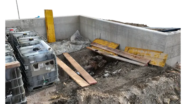
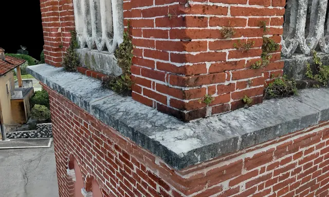
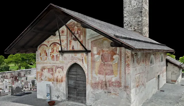
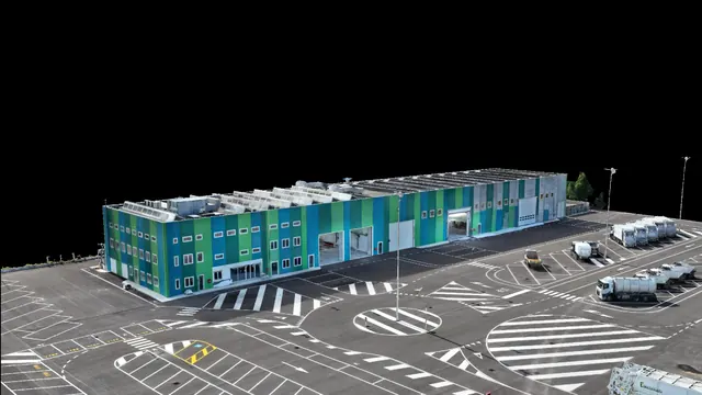
Examples of 3D drone surveys for different sectors and applications: cultural heritage, topography, construction sites and industrial plants.
Technical Capabilities
Frequently asked questions about 3D surveys
Accuracy, turnaround, file formats and costs of drone surveys.
How much does a 3D drone survey cost?
How accurate is an RTK drone survey?
How soon do I receive the survey data?
Which files do I receive and which software opens them?
What is the 3D web viewer and do I need to install anything?
What is the difference between DTM and DSM?
What are drone surveys used for?
Where do you carry out surveys?
Are the pilots licensed and are the surveys insured?
It's the most practical tool we provide: it solves the problem of heavy 3D files clogging up computers. You'll receive a private, optimized web link to explore the survey in real time directly in your browser, with no complex software to install.
- • Smooth navigation on any device: open the link from a smartphone, tablet, laptop or Mac
- • Professional measuring tools: measure real distances, building heights, slopes and perimeters with millimetric precision
- • Instant calculation of excavations and stockpiles: select the outline of a site area to instantly calculate the volume in cubic meters
- • Instant sharing with clients and colleagues: just send the link via WhatsApp, email or attach it to a quote
- • Multi-layer views: switch with one click from the high-resolution photo to the elevation map or the point cloud
HTML5 Web Link / 3D Cloud Platform
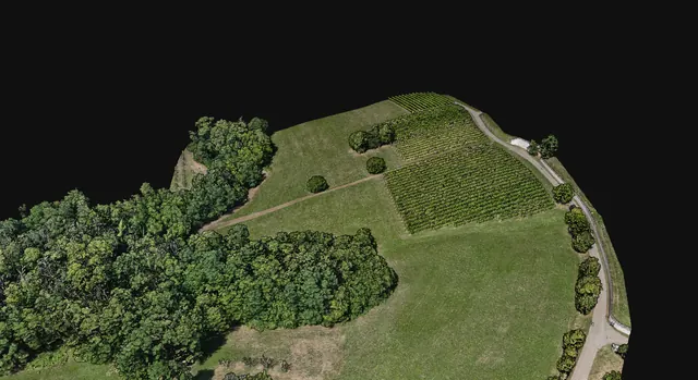
A volumetric scan of space made up of tens of millions of coordinate points (X, Y, Z). Every single point carries its real spatial coordinate in the chosen geodetic system and the photographic RGB color.
- • Millimetric/centimetric accuracy verified with a D-RTK station
- • Essential starting point for reverse engineering, extraction of plans and elevations
- • Ground classification with filtering of vegetation and moving obstacles
- • Import into CloudCompare, Revit, AutoCAD and 3D scanning software
.LAS, .LAZ, .PLY, .E57
A continuous three-dimensional surface generated by connecting the cloud points through millions of triangles, onto which the photographic texture is applied at original resolution.
- • Perfect for architectural renderings, realistic visualizations and visual-impact simulations
- • Direct import into the main CAD and BIM software (Rhino, SketchUp, Blender, Revit)
- • Faithful documentation, frozen in time, of the as-built condition of the work
- • Ability to extract sections and profiles directly from the solid model
.OBJ + .MTL, .FBX, .3DS, 3D Tiles (.B3DM)
A huge orthorectified aerial photograph, free of perspective tilt and corrected for terrain variations, with a level of detail (GSD) down to a few millimeters per pixel.
- • Direct real-world measurements at 1:1 scale of surfaces, roofs, yards and property boundaries
- • Immediate integration with cadastral maps, regional technical maps and GIS software (QGIS, ArcGIS)
- • Essential tool for appraisals, site accounting and quantity take-offs
- • Perfect cartographic base for preliminary design
GeoTIFF, high-definition JPG + World File (.JGW)
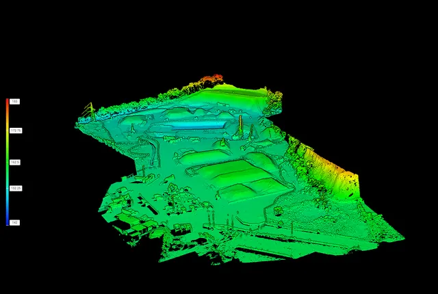
Digital elevation maps: the DTM (Digital Terrain Model) represents the bare ground cleared of plants and buildings, while the DSM includes every volume above the ground.
- • Analysis of elevations, percentage slopes and rainwater runoff lines
- • Differential calculation between successive surveys to quantify earthmoving (cut/fill)
- • False-color map to read elevation differences and geomorphological issues at a glance
- • Integration into GIS software for territorial analysis and planning
GeoTIFF Raster, Grid ASCII (.XYZ)
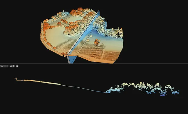
2D and 3D vectors ready to be opened directly in AutoCAD with no intermediate conversion steps.
- • Primary and secondary contour lines with customizable interval (e.g. 20 cm, 50 cm, 1 m)
- • Longitudinal and cross-section tracing along any requested alignment
- • Files organized on separate layers for elevations, contour lines, excavation edges and buildings
- • Output ready for design and technical documentation
.DXF, .DWG, Vector PDF
Contact us for a quote
Have a project in mind? Tell us about it: 3D survey, FPV drone filming or website. We reply within 24 hours.
General Email
normale@normale.cloudRegistered Office
Via dell'industria 30, 34144 - Trieste (TS)
Operations Office
Viale della Pace 54, 36010 - Zanè (VI)
Send us a message
We reply within 24 hours. Tell us about your project and we'll help you make it happen.
Glauco Amoroso
Surveys Contact
Naval engineering student at the University of Trieste
Mauro Amoroso
Cinema Contact
Student at the F. Corradini science high school in Thiene